

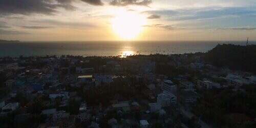
by Mad Max. Mt Guiting-Guiting, the toughest mountain of the Philippines – this mountain has fascinated me since I first saw it on Boracay in good weather over a week ago, and that’s over 100 kilometres away. The tour takes three days, I want to do it all in two days.
A tough schedule and perhaps a little overconfidence? We’ll see. Guiting-Guiting means something like scissors. The peak, which juts out of the surrounding countryside into the sky like a pair of scissors, hangs in the fog. After our sunny moped tour over the last few days, we might be lucky with the weather. I gladly accept Frank’s offer and write the report on the mountain after we have parted ways for two days.
My guide tells me that another group wants to climb Mt Guiting-Guiting on Monday and that there is a team meeting the evening before. I come along and realise that this is a group of nine climbers plus six guides and porters. The group calls itself “Hike for Light” and distributes solar-powered torches to guides in the Philippine mountains. One of the sponsors is “Stiftung Solarenergie” from Germany.
Among them is the first Filipino to climb Mt Everest. I can’t remember his name, but have a nice chat with him about his expedition to the roof of the world six years ago. The group speaks good English, unlike the guides.
As mentioned, the summit ascent is a three-day tour:
Day 1: Start from sea level on Mayo’s Peak (1500m above sea level), overnight in a tent.
Day 2: Ridge walk to the summit of Mt Guiting-Guiting (2058m a.s.l.) and back to camp.
Day 3: Descent from camp
I want to combine day two and three into one, so that it is a two-day tour.
The meeting point is at six o’clock with one of the guides. I’m ready. Everyone is there. But not ready yet. I wait until 7.15. As people are still packing and unpacking and some are having breakfast, I run out of patience and set off on my own with my guide Jerry.
Jerry has no luggage – but he is wearing flip-flops. I ask him if he’s serious about going up in his slippers. He just grins, doesn’t understand a word. Funny bloke. A few houses further on, he picks up his rucksack and his son Chad. I’m surprised. I guess the son has to do the lugging. But hopefully he realises that I’m only paying for the guide, that was the deal after all.
The ascent begins with a few kilometres of walking between grassland and rice fields, between cows, oxen and several chickens. They cluck, grunt and moo happily, everyone is in a good mood. At least I am, because I can’t talk to the guide and his son.
My shoes get wet after five minutes – and stay that way for the next two days. The whole rainforest is muddy, slippery, clayey and there are several rivers to cross. Towards the top, it becomes increasingly steep and you have to climb rather than hike. After just over five hours, you reach Mayo’s Peak and the camp.
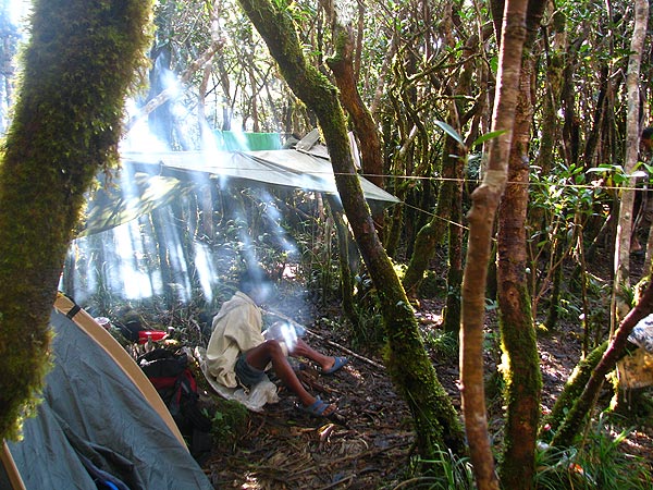
The camp is basically the forest floor. The guides set up the tent. There is no straight surface at all. Roots everywhere. The guide cooks rice, we open a few of the sausage tins. Tastes disgusting. The sun comes out in the afternoon and I sunbathe on the summit of Mayo Peak. It’s pleasantly warm.
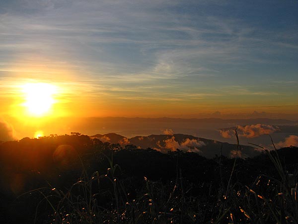
The hike-for-light group arrives two to four hours later. It’s a good thing I walked at my own pace. Once all nine tents are up, we enjoy the sunset from Mayo Peak. It’s almost cloudless. Probably the first time in weeks. What luck. And this sunset. What madness! You can see as far as Mindanao and Mt Mayon, the most active of the Philippine volcanoes, is also visible.
The night is very cool. So cool that I can’t sleep. Not for a minute. The three of us share the tent. No sleeping bag. No sleeping mat. And what feels like ten roots under me. It’s uncomfortable in all positions. And freezing cold, I’m freezing from the moment I fall asleep until I wake up. The two guides sleep peacefully, even without a blanket.
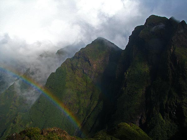
Wake-up at six o’clock. I’m surprisingly fit for the night. My guide boils hot water for an instant noodle soup, he himself only eats rice and another tin of that disgusting tinned sausage. I walk the fifty metres to the summit – it’s breathtaking. Cloudless, dawn, the summit of Mt Guiting-Guiting silhouetted and an incredible view. And this view makes me realise just how steep this climb is going to be.
After my first tasting, or shall we say, eating, I say goodbye to the other group. I actually want to hike up with them, but as they are messing around again and we want to be down before sunset, I decide to climb with just the two guides.
The path first leads down about 200 metres in altitude over Knife’s Edge. This ridge descends very steeply on both sides. It’s not hiking either, it’s more like cliff climbing. The cliffs are so sharp-edged that a single misstep would cause at least a severe haemorrhage, perhaps even broken bones. Sometimes there are overhangs that you have to shimmy along. A look down tells me that I have a clear view for about 20 metres. Not good. Don’t think about it.
Towards the summit, it gets even steeper, with a 45-60 degree gradient. If you fall, you might not stop, but roll down over the cliffs. Don’t think about it. Fog rolls in and stays until the summit.
A small rivulet serves as a source of water and we fill our bottles. For the last hundred metres, we climb almost vertically, leaving my rucksack on the rock. The so-called kiss-the-wall is practically almost vertical climbing. Without belaying, of course. If I had known all this beforehand, I might not have done it.
The summit of Mt Guiting-Guiting is pretty boring, a small plateau. Surprisingly flat after a very steep ascent from all sides. After two minutes I want to start the descent, because there’s nothing to see. Visibility is only a few metres.
The descent is no less challenging. Due to the fog, all the cliffs are now slippery. About halfway back, we meet the hike-for-light people who set off shortly after us. Really slow bunch. They left one of the climbers behind. He had some photo equipment with him and said he was at the end of his tether and was slowing the group down. He was alone.
My guide wants to take him back to camp with us – but he’s incredibly slow. I think back and forth about whether we should leave him behind because otherwise we won’t have enough time, or whether we should be social. We were social for about 45 minutes.
Back at camp, we break everything down, refill the rucksacks with everything we didn’t need on the summit and start the descent. Everything is slippery, muddy and slippery. Our arms and legs are covered in bloody scratches because some of the flora cut into our skin.
We make it back just after sunset. My legs are totally exhausted. But I’m happy that nothing has happened to me, that we haven’t had any rain and that I now have two hamburgers ahead of me. The ascent was five hours, the summit 3.5 hours, the descent seven hours.


 Frank Woelky, born in 1973. Kitesurfer since 1998. Since 2006, I have been combining kitesurfing and web design on trips lasting several months off the beaten track.